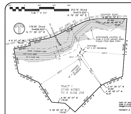
Weather (wet) and paperwork (govt.) have combined, and we have missed our goal… but we’ll keep at it. In the meantime, here’s our site plan. Notice the shaded area around the creek at the upper part of the diagram – it’s a big floodplain. That means the Army Corp of Engineers is very interested in what happens there. I had a friend tell me he built a dam across the same creek (further upstream) and the ACOE apparently saw it on an aerial map and paid him a visit. It worked out, but … we don’t really own that land – the Army Corp. does. But we pay the taxes. Sigh…